Abergavenny Active Travel Bridge scheme including Llanfoist Links & Castle Meadows
We are focusing on active travel links between Llanfoist and Abergavenny, with our route designed around a new active travel bridge crossing the River Usk between Merthyr Road and Castle Meadows, and associated links for safer, more attractive and direct sustainable routes into Llanfoist and Abergavenny.
Monmouthshire County Council has secured £10.4m from Welsh Government’s Active Travel Fund to develop the Abergavenny to Llanfoist Active Travel Scheme. Our construction partner for this scheme, Balfour Beatty, appointed under the SCAPE framework, will soon launch a scheme website – we will share the link here when it is available.
This scheme is a central priority for the development of Monmouthshire County Council’s Active Travel network, addressing the active travel severance point of the Merthyr Road bridge. This funding is bid for in a competitive national bidding process and once allocated is ring-fenced for this active travel project and cannot be spent on other projects, schemes or council services.
What is the change we expect to see?
- Increase in active travel journeys in Abergavenny
- Improved connectivity and accessibility for active travel trips in and between Llanfoist and Abergavenny
- Improve actual and perceived levels of personal safety and security when walking and cycling
- Promotion of sustainable travel as attractive and safe in Abergavenny and Llanfoist.
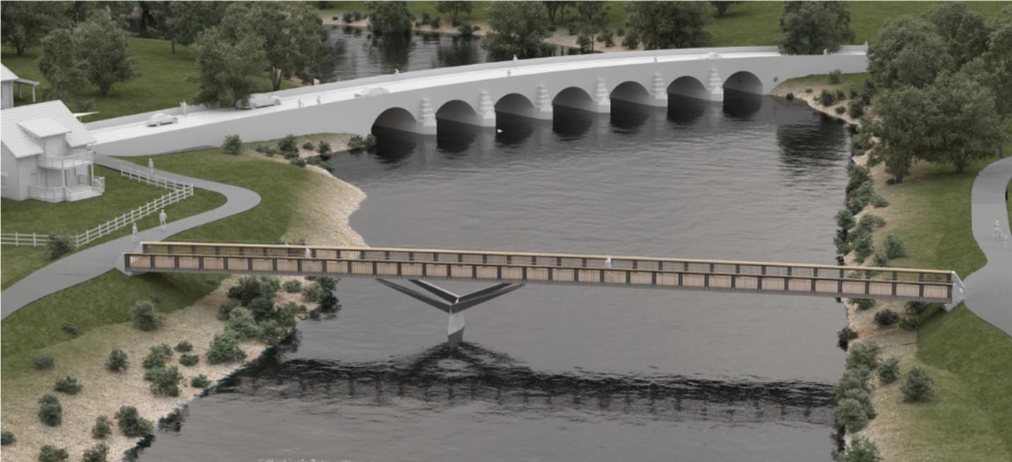
Active travel bridge
Objectives of the active travel bridge scheme
Provision of a new walking, wheeling and cycling bridge crossing on the Usk between Llanfoist and Abergavenny, downriver of the Usk Bridge (Merthyr Road). The bridge will become the main river crossing for active travel between Llanfoist and Abergavenny, as an alternative to using the narrow footway over the existing road bridge and encourage modal shift as a result.
Identified issues for active travel between Llanfoist and Abergavenny on Merthyr Road
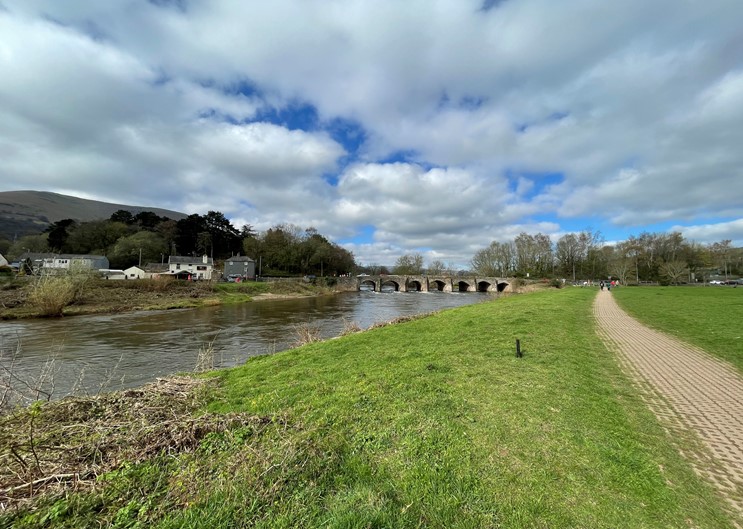
Merthyr Road/Usk Bridge has long been identified as a severance point for active travel, and MCC has prioritised the development of this route. The existing bridge over the River Usk provides a very narrow footway on one side and does not cater for cyclists. The road bridge is a listed structure that carries a heavy volume of road traffic. There is currently little scope physically, or with its listed status, to make it more welcoming or safe for active travel. The overall aim is to provide an alternative river crossing for active travel, and ensure effective connections from the bridges (new and existing) into the town centre, allowing healthy travel between homes and key destinations such as schools, Nevill Hall and the town centre.
Proposed Interventions – Active travel bridge
This scheme will construct a new 3m wide walking, wheeling and cycling bridge across the River Usk, linking Llanfoist to Castle Meadows, Abergavenny. The bridge will be made of a steel beam construction with wooden cladding to ensure that it fits in with the natural surrounding area. Ramps will be constructed to connect the bridge to the paths on Castle Meadows and footway on Merthyr Road, Llanfoist.
Construction of the bridge is planned to commence in early 2026, with phased work continuing into 2027. Planning permission was granted for the active travel bridge in 2018 as DM/2018/00408, with permission granted in 2025 for non-material amendment to include steel beam construction – planning number DM/2025/00507.
Balfour Beatty, scheme construction partners, will soon launch a scheme website – we will share the link here when it is available.
Castle Meadows
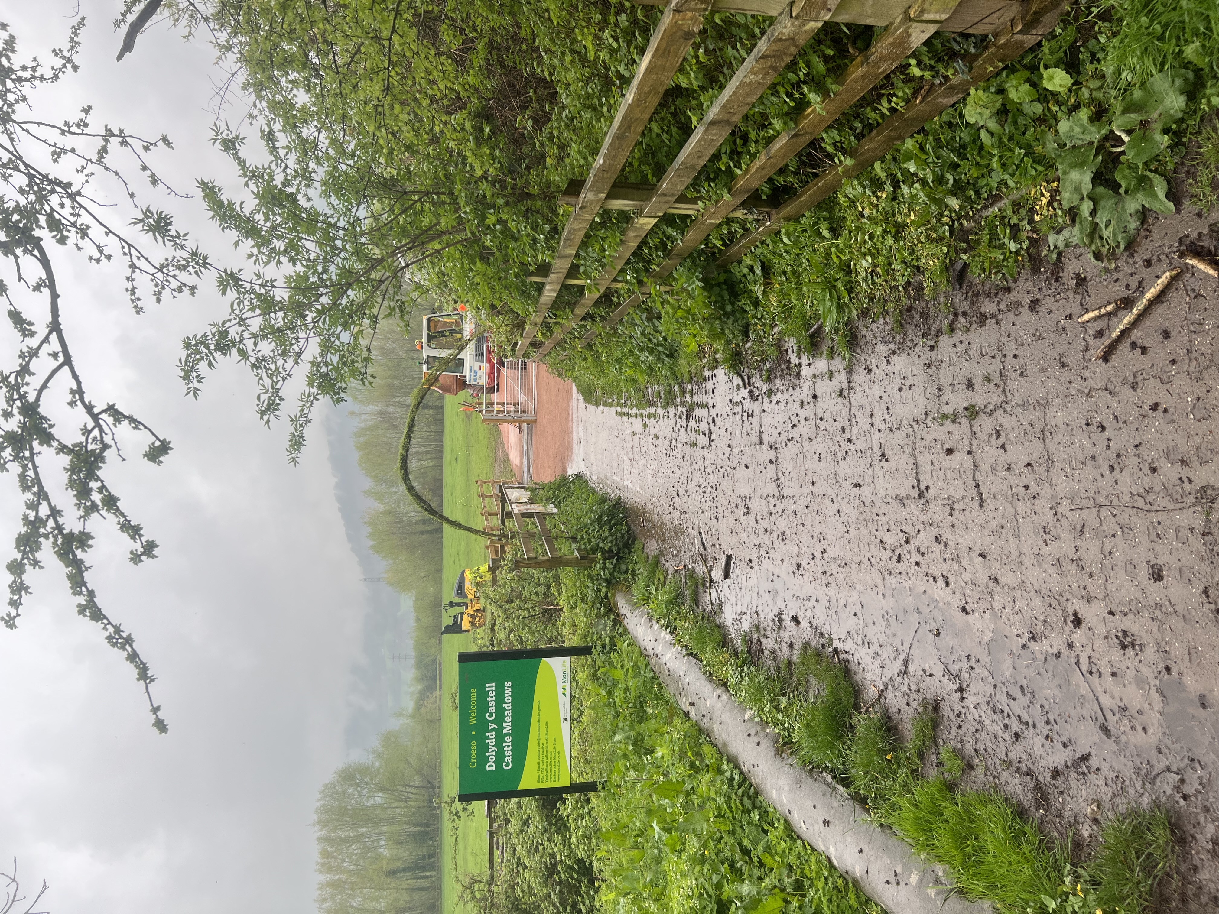
Castle Meadows and Ysbyty Fields are important leisure areas for the community and are crossed by Public Rights of Way (PRoW) and National Cycle Network routes 42 and 46. Improvements to the surfacing of routes on Castle Meadows can support pedestrians and cyclists travelling between Llanfoist and Abergavenny, in combination with the new active travel bridge.
As the scheme progresses further work will identify possible upgrades to paths within the meadows with the current funding available. The full extent of paths with potential for upgrade on Castle Meadows gained planning permission in 2023, as planning application DM/2022/01831.
Objectives of the Castle Meadows scheme
The objectives of the scheme have been derived through identification of key issues (as summarised above), and also according to the objectives set by the MCC and national policy. The objectives are as follows:
- Ensure connections from the town centre through Castle Meadows to Llanfoist are accessible, to allow people the option of alternatives to driving this route.
- Increase the number of pedestrians and cyclists using Castle Meadows for commuting and leisure purposes;
- Make a positive contribution to air quality by promoting active travel
- No significant adverse impacts on environmental sensitive receptors during construction and operation, protect and enhance the historic, built and natural environmental including landscape and settlement character of the area.
Identified Issues on Castle Meadows
- Inaccessible and unattractive route across road bridge causes restricted access to Castle Meadows.
- Grasscrete paths: The existing grasscrete paths are in a poor state of repair and don’t comply with active travel guidance for path surfaces. They are uncomfortable and difficult for wheelchair / mobility chair users to use.
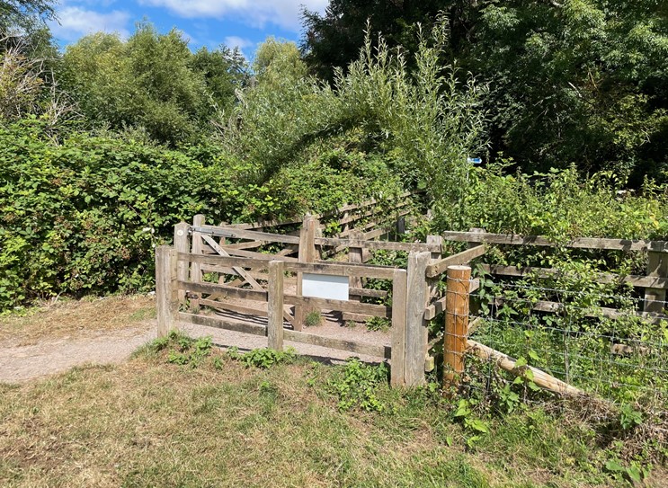
- Restrictions at access points: A self-closing, latch-free gate has been trialled on the meadows for the last two years. The gate opens into the meadows, meaning cows cannot push the gate open and venture out. The existing wooden style kissing gates are restrictive to wheelchairs, mobility scooters, pushchairs, and cyclists gaining access to the meadows.
Proposed Interventions – Castle Meadows
The WelTAG (Wales Transport Appraisal Guidance) study of this area looked at ways to improve the provision for active travel on Castle Meadows. Following this study, MCC sought planning permission to upgrade all of the main paths on Castle Meadows, pending funding availability and to allow flexible planning as the bridge plans were developed. MCC does not plan to upgrade all paths within the planning agreement, but is working to include some paths within the current scheme of works.
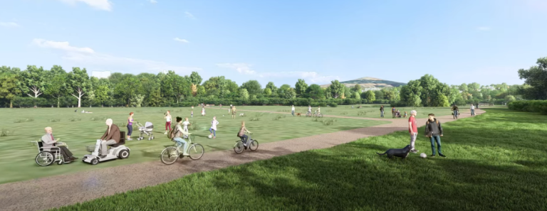
Image: Artists impression of Castle Meadows paths. N.B. MCC does not plan to upgrade all paths within the planning agreement as part of the bridge construction works.
Llanfoist Links
This phase looks at route improvements focused on the Llanfoist side of the River Usk and connections to the active travel bridge and Castle Meadows. Elements of this broad scheme will be included in the construction works, with other sections being brought forward as and when funding allows.
Objectives of the Llanfoist Links scheme
- Improve access to local services, employment, and cultural facilities by Active Travel modes by improving connectivity between Abergavenny and Llanfoist.
- Promote and facilitate healthier lifestyles by increasing the number of pedestrians and cyclists using Merthyr Road and The Cutting for commuting purposes.
- Make a positive contribution to air quality by promoting active travel in MCC and supporting the reduction of Carbon Dioxide around the Abergavenny / Llanfoist area.
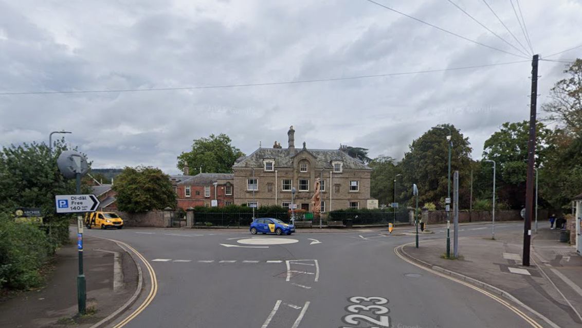
- Introduce safe and accessible active travel links and remove conflicts between users around the ‘Waitrose’ Roundabout.
- Provide a coherent, direct, and future-proof cycle route which connects with the existing and planned active travel infrastructure.
Identified issues in active travel between Llanfoist and Merthyr Road Abergavenny
- The existing road network in the area is extremely busy, making the environment unappealing for pedestrians, cyclists, and those with mobility impairments. Analysis of 2011 Census data identified that 15% of drivers in the area travel less than 2km and 8% between 2km and 5km. Some of these trips could be accommodated by Active Travel modes if adequate Non Motorised User infrastructure would be provided.
- There are currently no off-road cycle facilities: as such cyclists have to use the existing carriageway/s to travel.
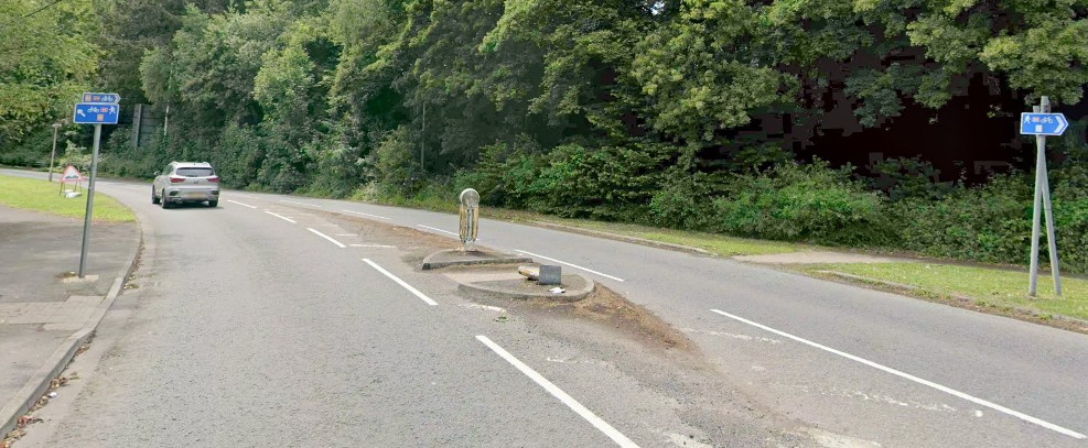
- A lack of adequate crossing facilities at the ‘Waitrose’ roundabout.
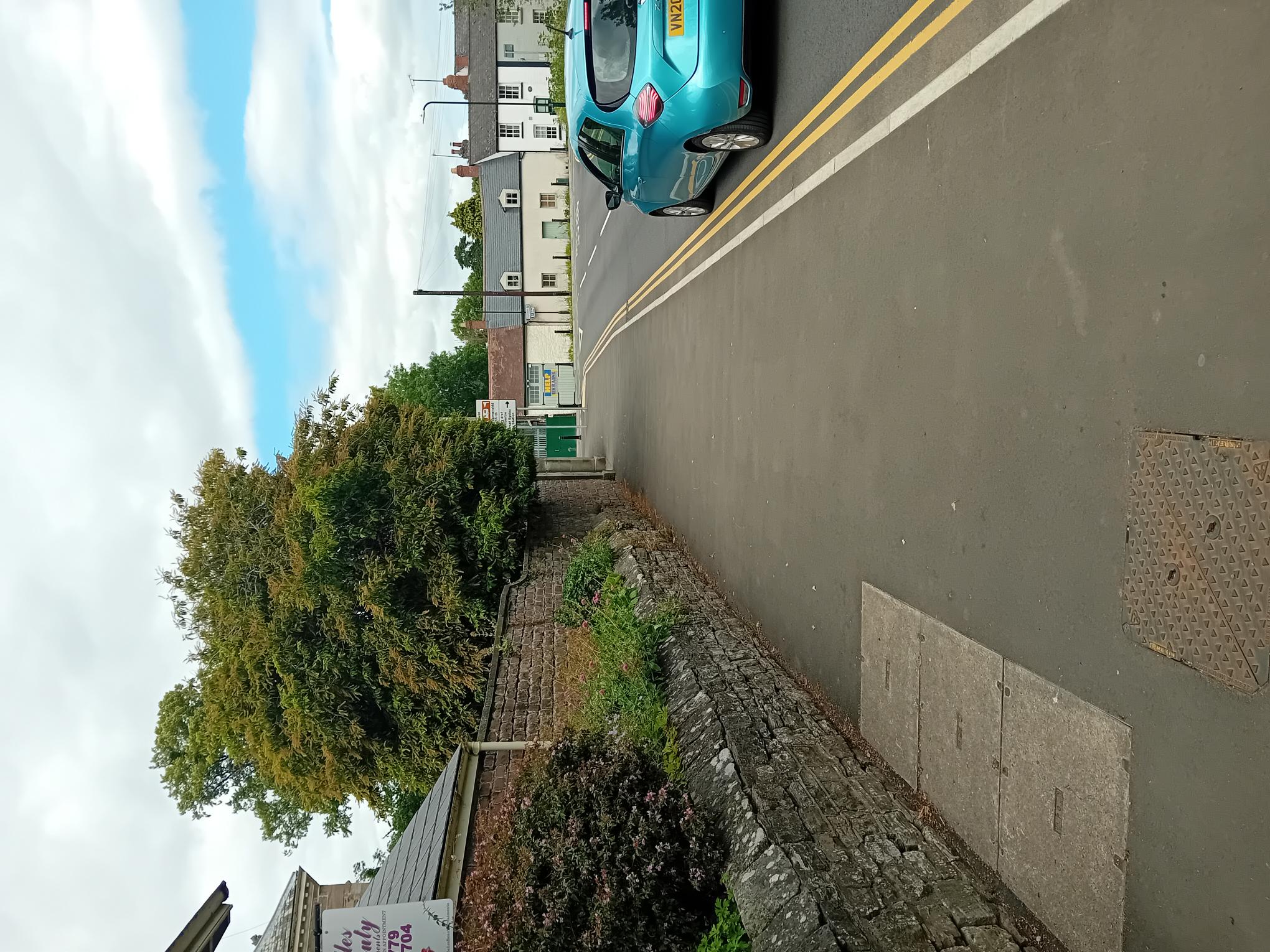
- At sections of the scheme, footways are narrow and sub-standard, forcing pedestrians into close proximity to the carriageway and traffic.
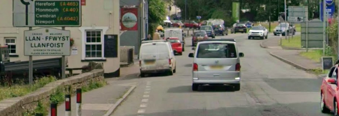
- There are significant perceived road safety issues, particularly along Merthyr Road between the Bridge Inn pub and ‘Waitrose’ roundabout.
- The Cutting is recognised as low traffic and, as such, has the potential to serve as a link from Merthyr Road to Llanfoist, but the current link route behind Waitrose Petrol Station is narrow and overgrown at points.
Proposed Interventions –Llanfoist Links
The Wales Transport Appraisal Guidance (WelTAG) study of this area looked at ways to improve the provision for active travel links between Llanfoist and Abergavenny and proposed the interventions below. Some interventions included on this list will be rolled out as development and construction funding becomes available, with others to be re-investigated once the bridge is constructed.
- The widening of the existing footway along the eastern side of Merthyr Road between the Bridge Inn pub and ‘Waitrose’ Roundabout, to accommodate a 3.5m wide shared (pedestrian and cycle) route. To accommodate this proposal, on-street parking at this location will be removed.
- The provision of new crossing facilities across three arms of Merthyr Road.
- The widening of the existing footway along the eastern side of Merthyr Road between Waitrose Roundabout and the Heads of Valleys Slip Road / Merthyr Road Roundabout to the south to accommodate a 3.5m wide shared (pedestrian and cycle) route.
- The widening of the existing footway along the eastern side of Merthyr Road between the Heads of Valleys Slip Road / Merthyr Road Roundabout and Gypsy Lane, to accommodate a 3.5m wide shared (pedestrian and cycle) route.
- The provision of improved more direct crossing points across Coopers Way and the eastern and western arms of the Heads of Valleys Slip Road / Merthyr Road Roundabout.
- The widening of the existing footway along the back edge of the car park located to the immediate north of ‘Waitrose’ Roundabout, to accommodate a 3.5m wide shared (pedestrian and cycle) route.
- The widening of the existing footway along the back of Waitrose Petrol Station between ‘Waitrose Roundabout’ and The Cutting Heads of the Valleys Road underpass, to accommodate a 3.5m wide shared (pedestrian and cycle) route.
- The promotion as a ‘Quiet Way’ (through additional signage and road markings) of The Cutting (without impacting the existing access and parking arrangements) between The Cutting Heads of the Valleys Road underpass and Merthyr Road to the south.
- The improvement of the existing The Cutting and Merthyr Road priority junction arrangement.
Llanfoist Links WelTAG study scheme diagrams
Proposals along Merthyr Road – Section 1
Proposals along Merthyr Road – Section 2
Proposals along The Cutting – Section 1
Proposals along The Cutting – Section 2
For more information on MCC’s work on active travel in Abergavenny, please visit Abergavenny – Monlife